Casco Open Space Inventory
The Sebago Geospatial Team developed an Open Space Inventory for the Casco Open Space Commission for asset management, funding acquisition, and future planning.
Location
Casco, Maine
Sector
Municipal
Services
- Land Surveying
- GIS Mapping
Project overview
The Inventory was designed in ArcGIS Pro and consists of a geodatabase and web-based Workbook with information about open space parcels and public access points.

project Details
Collaborative categorization
Feature information was first gathered via desktop inventory, then coordinated in consultation with Casco Open Space members, interested citizens, and local land trusts in a virtual meeting.
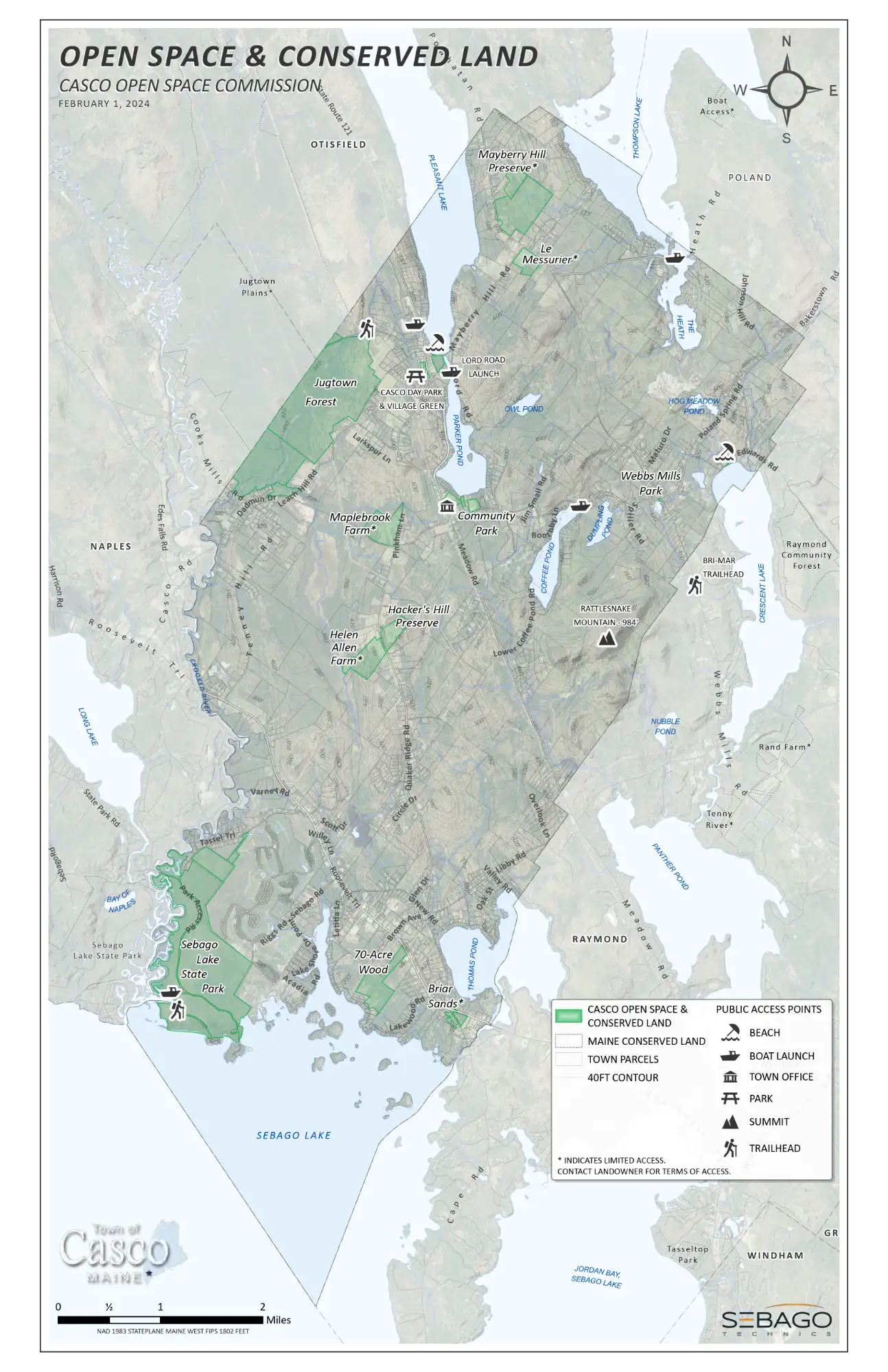
Local participation revealed assets not available through public data sources such as additional boat launches and trailheads. Sebago then revised the Inventory and provided an updated web-based Workbook to the Casco Open Space Commission. Information contained in the Workbook includes asset type, location, ownership, and access type (fee or free). The Inventory establishes a baseline while the web-based Workbook promotes legacy asset management as the Open Space Commission acquires new assets, or members join or retire.
In addition to the Open Space Inventory & Workbook, the Geospatial Team designed Open Space Maps for the Town of Casco website and generated an interactive web map that can be integrated into the Town website to promote public awareness and discovery of Casco’s Open Spaces.
Explore related projects
See how we transform plans into impactful places across the region.