By Seth Goucher, Director of Geomatics
As Winter turned quickly to Spring, Sebago’s Geomatics Team has once again endured difficult weather and challenging projects. The team spent most of the frigid fall and winter months completing two of the largest laser scanning opportunities Sebago Technics has been challenged with to date. They range from a large acreage tract, requiring extensive detail extraction to a full documentation laser scanning data set of a 14-story iconic building towering over the downtown Portland skyline.
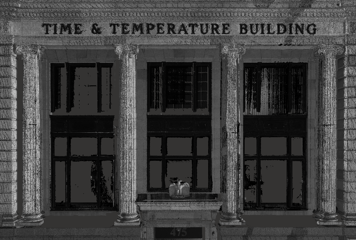
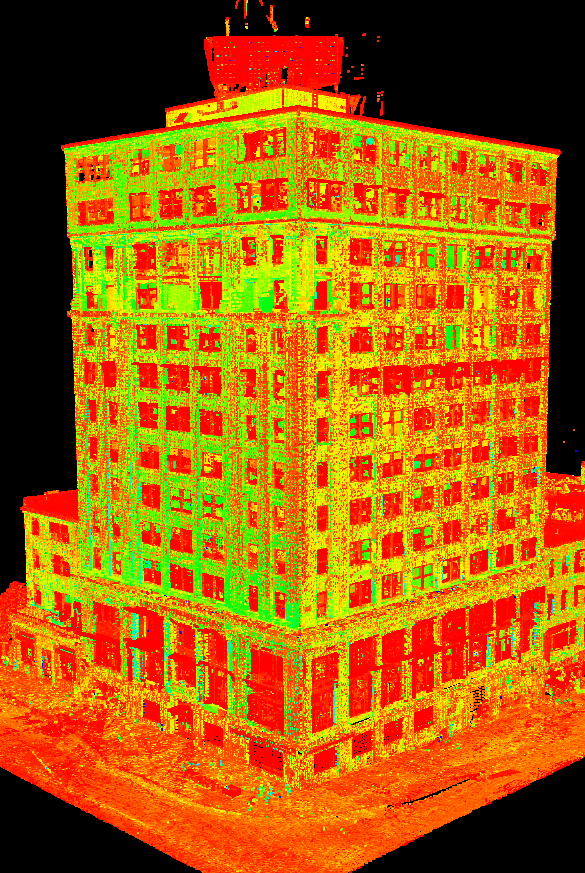
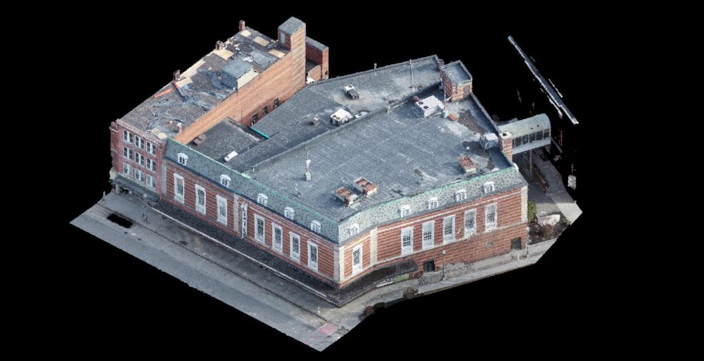
Time & Temperature Building – Portland, Maine
Client: Real Estate and Development HRI
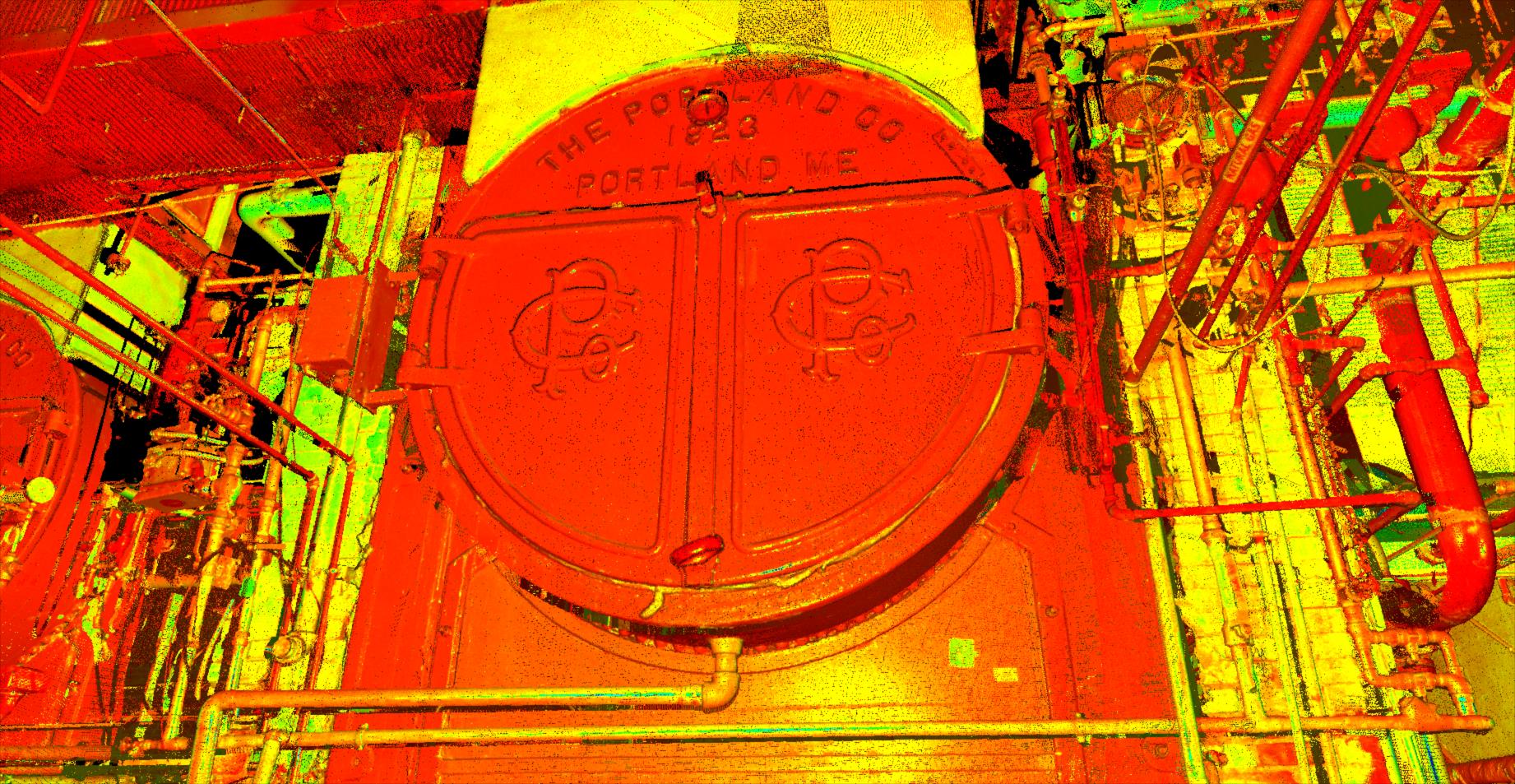
Summary: Soaring 14 stories into the Portland skyline and covering almost an entire city block at its base level, the Time and Temperature Building project presented several daunting challenges to the team. One being that of 14 separate levels with additional full basement and sub-basement area, the team was tasked with laser scanning the entire exterior and all interior spaces and ultimately producing a survey-grade point cloud data set. This point cloud would be further broken onto 50+ subsequent datasets, leveraged by the design architect to validate an existing floor layout plan and moreover aid in the re-design and repurposing of the building space.
Survey control was set around the exterior and through the interior structure itself, serving as the basis for constraining the massive 1.5TB data set consisting of over 1,200 individual scans. Snow piled up and the temps dropped into the single digits, the team was happy to have collected the exterior façade and roof data while the early winter weather allowed. Remaining warm and dry, the crew continued scanning the expansive sprawling interior area. The most complex being the first 4 elevations and basement areas as they endured multiple remodels, and multiple buildings being woven together over time, the expanse of one-way corridors and dead-end hallways abound.
Colby College Campus – Waterville, Maine

The Team was tasked with taking on the challenge of collecting roughly 28 full acres of developed area within the confines of the Colby College campus. A perimeter of the area laser-scanned totaled just over 1.5 miles with the scope of service items ranging from parking lot area topography, street and curb detail, buildings footprints, façade features, all existing shrubbery, planting beds, utility locations, stormwater and sewer locations.
A late fall project approval found the team facing below-freezing temperatures, rain, sleet, and impending snow cover. A plan was established, systematically breaking the large tract into smaller priority target areas. This break in areas allowed the laser scanning team to stay ahead of the utility locating and field survey team, effectively staggering the fieldwork to minimize crew overlap. Leveraging two laser scanners, first being the Leica P40 for its survey-grade accuracy serving the backbone of the database control, the team scanned the major walkways and landscape areas.
The faster more versatile Leica RTC360 was set free to collect data around intricate buildings structures, alleyways, inconspicuous areas, and corridors. The team accomplished the laser scanning field collection over 3 days, scanning from daylight to dusk. The project scope was compiled from 400+ individual scan setups, with an overall point cloud accuracy error of less than ¼”. The team then turned to Leica’s Cyclone software to extract all the required data from the point cloud from the confines of a warm conditioned office. As the snow piled up outside and the lakes and ponds froze hard, making outside fieldwork ever more difficult and time-consuming, the team completed the extraction of the required data and final creation of the project deliverables.
A New Perspective
By Josh Eon, PLS

From mapping roadways, construction sites, and open-pit mines to inspecting free-standing structures, such as bridges and towers, Sebago Technics is proud to offer a number of UAV Mapping Solutions. To start, UAV stands for “Unmanned Aerial Vehicle” also known as a drone. This piece of equipment tends to get the most glory, but in fact, is only one piece of our entire workflow.
When combined with the correct sensor, software, and proper survey methods, Sebago Technics can create highly accurate models of any terrain or structure in a fraction of the time. This allows us to produce accurate results for our clients with a quicker turn-around and at cost savings compared to traditional means. Additionally, when traditional survey methods are implemented, they almost always take place on the ground and collect one piece of data at a time. With our UAV, we capture millions of pieces of data in less time from the air, which gives a better overall perspective of any site than that of a traditional survey.
All of the UAVs at Sebago Technics are FAA registered and each operator holds an FAA Part 107 certificate, which is required when performing UAV work commercially. With this certification comes the extensive understanding of all FAA regulations pertaining to UAVs such as airspace classifications and restrictions, aeronautical weather reports, and knowing the proper channels of communication to gain access to restricted airspace.
Stay tuned for all of our upcoming UAV projects and updates; it’s looking to be a busy and exciting season!
For more information, please contact:
Seth Goucher
Director of Geomatics
sgoucher@sebagotechnics.com
207.200.2070