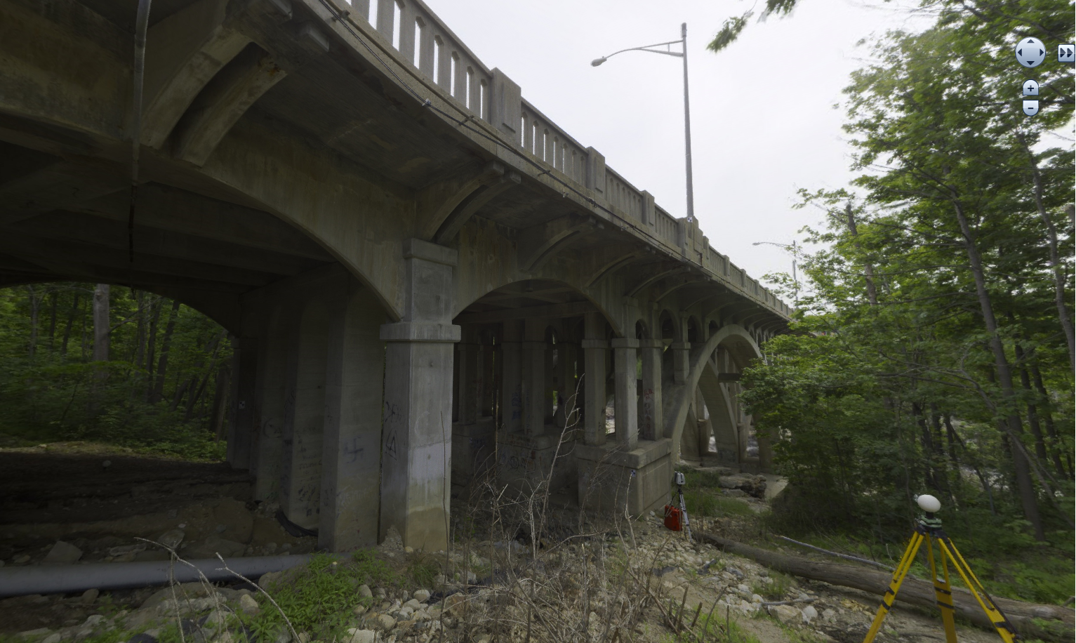
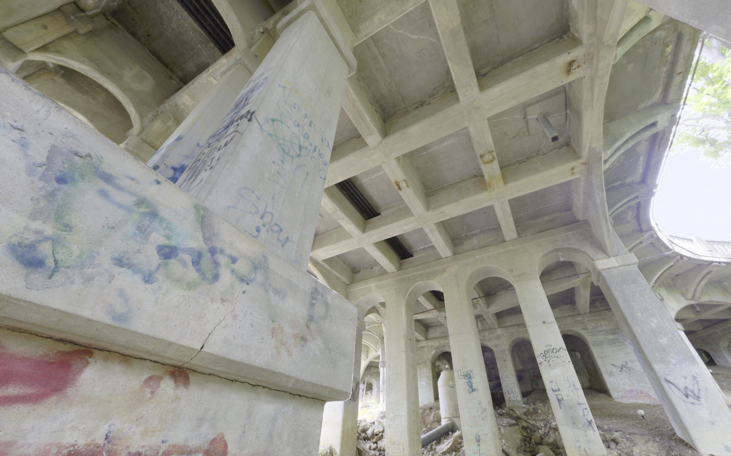
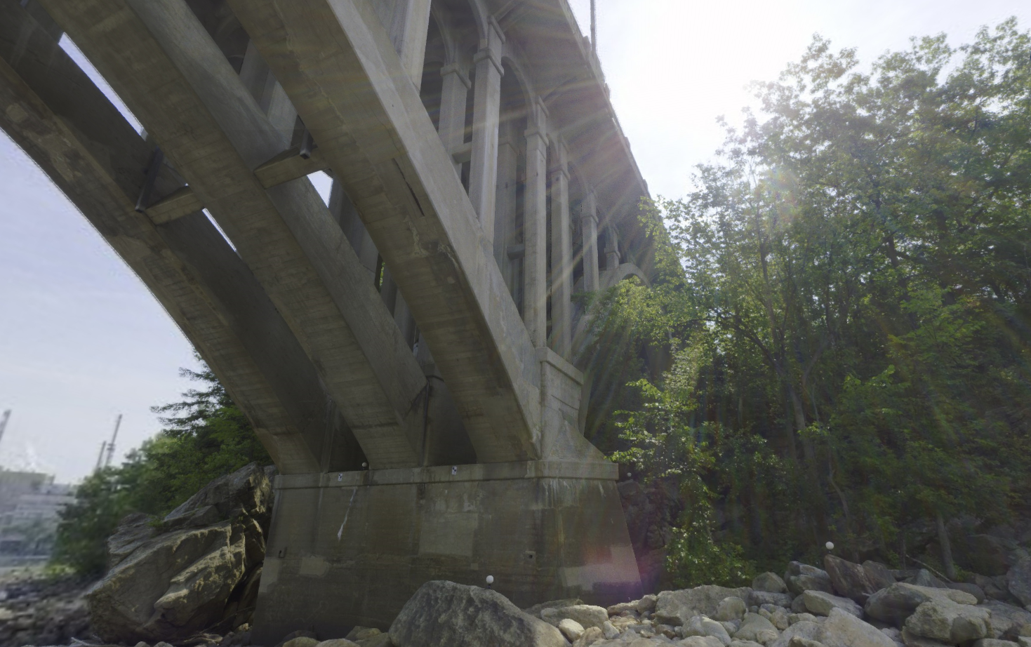
Rumford, Maine
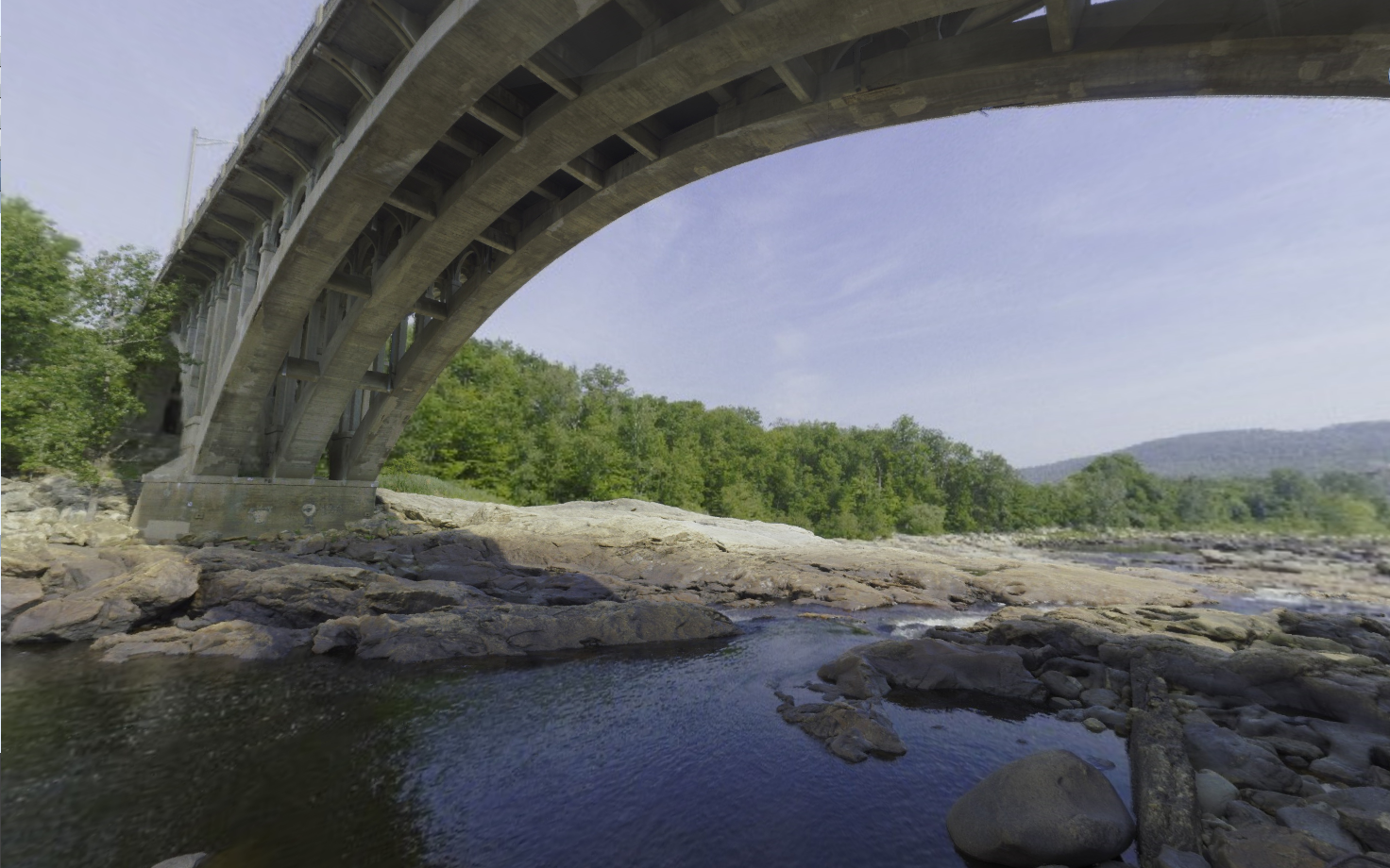
The Maine DOT contracted the Sebago Technics Geomatics division to capture the existing condition of the Chisholm Park Bridge in Rumford, Maine using high definition laser scanning.
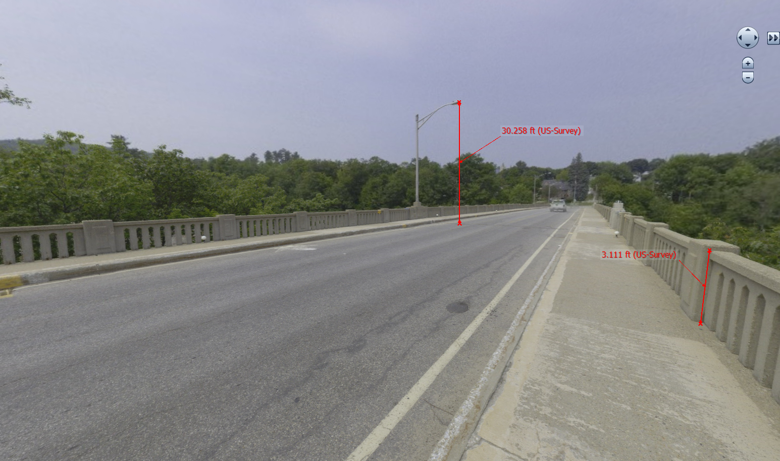
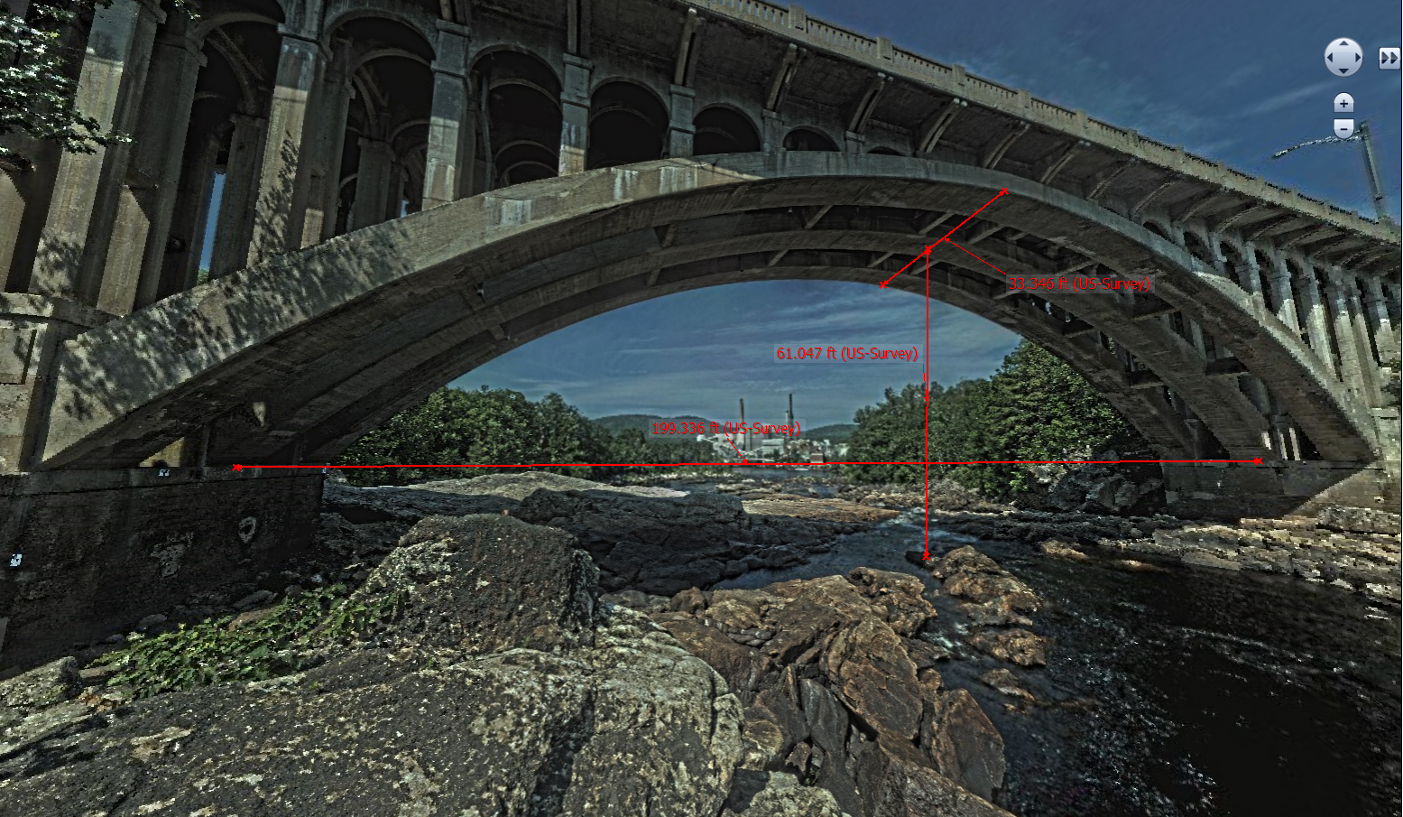
The point cloud is made up of millions of tiny geolocated data points, all combined into over 1TB of data space. This data set will be the basis for the creation of a solid 3D model document for the rehab of the 89-year-old structure. Supporting the model creation is a file set of Leica published TruView documents.
Once published from the laser scan data set, TruView allows clients access to the survey point cloud and images with a multitude of tools to aid in visualization and collaboration, including measurement, markups, snapshots, Geotags and Hyperlinks. The intended purpose use of the 3D model and TruView data set range from project collaboration of the field construction teams, structural analysis and issue identification from bridge design engineers, and historical accuracy reference for structural rehabilitation specialists.
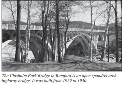
The Chisholm Park Bridge in Rumford is an open-spandrel arch highway bridge. Open-spandrel arch bridges were built nationally from about 1907 through the 1930s. Maine has one notable ribbed open-spandrel arch bridge, the Chisholm Park Bridge in Rumford, completed in 1930.