Geomatics is the measurement, analysis and management of data relating to the earth and the built environment. Also known as surveying engineering or geospatial science, Geomatics is the discipline of gathering, storing, processing, and delivering geographic information or spatially referenced information.
5 THINGS YOU NEED TO KNOW ABOUT GEOMATICS
- The science of deriving information about an object using a sensor without physically touching/ contacting it is called remote sensing, which is a key part of geomatics.
- Remote Sensing technologies can provide millions of points of land or structure-based data versus hundreds or a few thousand points from traditional surveying technologies.
- Typical technology and tools used in the collection and processing of data includes: Survey total station, 3D High Definition (laser) Scanner, Global Positioning System (GPS), Digital aerial imagery (Air-borne and satellite), and computer-based geographic information system (GIS).
- Geomatics Engineers design, develop, and operate systems to collect and process spatial information about land features, natural resources (gravel, stone, other misc. raw building material) as well as man-made features (buildings, bridges, industrial facilities (piping, steel structures, pumps, vessels, etc.).
- The more traditional practice of land surveying primarily focuses on the determination and recording of property boundaries and parcels of real-estate. Some tasks within the surveying discipline extend into the civil engineering field including topographic surveys, design and layout of public infrastructure, urban subdivisions, mapping, and control surveys for construction projects.
 LET SEBAGO SHOW YOU THE ADVANTAGES of GEOMATICS
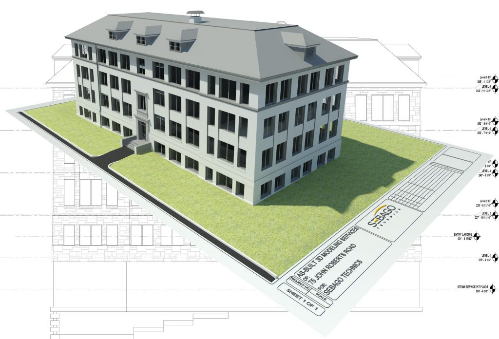
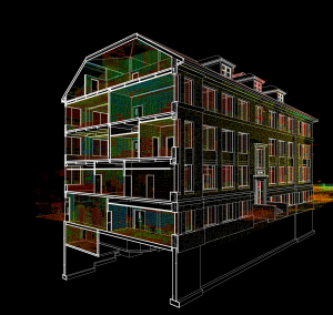
Whether it’s surveying a roadway, analyzing bridge components, documenting a historic building, quantifying material volumes or retrofitting an existing structure, High Definition 3D Laser Scanning is a highly accurate, time-reducing, and cost-effective solution. Sebago Technics has been scanning since 2013 and has successfully completed multiple projects over a wide array of project disciplines.
For more information and/or a demonstration, please contact:
Seth Goucher
Director of Geomatics
207.200.2070
Links to more information on Geomatics and Laser Scanning: