Authored by Terry Bennett, PLS LPF MRICS ENV SP LEED AP, Vice President, Survey-Geomatics.
In Honor of 2021 National Surveyors Week (Mar 21-27) & Global Surveyors Day (Mar 23), I thought it appropriate to look back in Surveyor fashion of where we have come from and where we are going. A slight recast of the land Surveyor’s tradition of ‘following in the footsteps of the previous Surveyor”.
It was in 1984 that ASCM (American Congress of Surveying and Mapping) established the National Surveyors week here in the U.S., This effort, subsequently signed as a Presidential Proclamation by President Ronald Reagan, was but a point in that path of footsteps. A path that goes way back and which provides us a long baseline and backsight by which to chart our paths and this profession going forward.
Surveying History and Lore
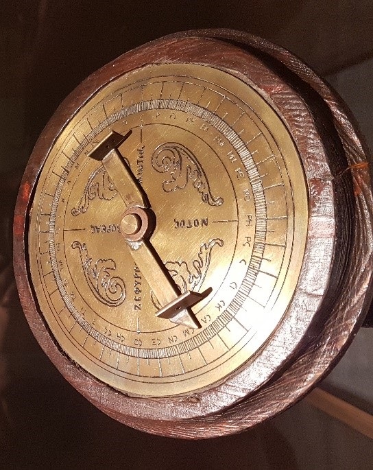
Records from 1400 B.C. indicated that the Egyptians employed surveying skills and knowledge in order to divide lands, starting the path we know today. The purpose for this work, well no surprise, for taxation. From that point forward, Surveyors have continued to forge ahead, broken new trails and remained pioneers of discovery both on the land but in applying technology to shape our natural and built environment world. A few cases in support of that premise. We can thank the Greek Surveyors for continuing that path, wherein 120 B.C. they developed the science of Geometry, the foundation of our mathematical work and used it along with one of the first survey instruments, a Diopter, to do land subdivision. Fast-forwarding about 2000 years later in 1800 A.D., was added the development of the science of Geodetic and plane surveying refining the importance of exact boundaries, and accurate positions of railroads, canals, highways and other prominent public improvements. This was the setting of the stage for the industrial revolution and the even tighter connection between Surveyors and Engineers in how we capture the existing to aid in the designing of our tomorrows.
Many well-known names from U.S. history have held the position of Land Surveyor and contributed to these footsteps of history, with George Washington, Thomas Jefferson, and Abraham Lincoln among them. What about the footsteps from those that are not as famous? Benjamin Banneker, a Surveyor and scientist who in 1789 was hired by then U.S. Secretary of State & fellow Surveyor Jefferson to survey the original borders of the District of Columbia, and assisted in the survey of the Louisiana purchase. Daniel Boone surveyed lands to resolve settlers land title issues, reminding us that some things never change. Boone however, never had any formal surveying education, so some of his work was, well let’s just say not up to survey standards.
Then there is Alice Fletcher, heralded as the first American women Surveyor. An ethnologist, anthropologist, and social scientist by training, she became a Surveyor and worked to allot Native American lands in the mid-1800s. Other survey pioneers include Major James Rennell, who surveyed and produced some of the first really accurate maps of Bengal with a scale of 1” to 5 miles. Pretty impressive for the time given that area’s geography and that climate. Sir George Everest, the guy that Mt. Everest gets its name from, whose footsteps in surveying history are as mammoth as the mountain named after him. Sir George surveyed almost the entirety of the meridian arc from the southern point of India north to Nepal and was a key leader in the Great Trigonometrical Survey of India. Many more Surveyors from around the world and over many centuries have helped all of us as professionals today with their knowledge, exploits, vision and inspiration. It is now for those of us who practice today to continue that path and excite a new generation of professionals with the footsteps we create.
Extending the Path & Creating New Footsteps for Others
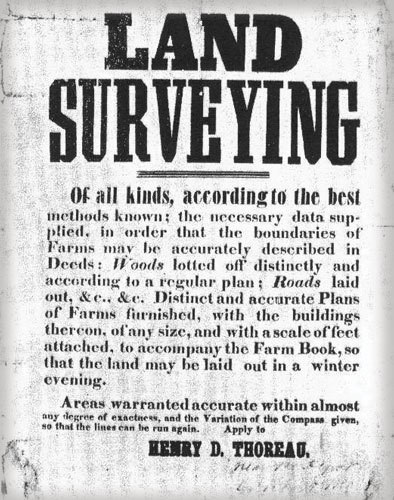
Image courtesy of Land Surveyors United.
While we won’t be inventing geometry, trigonometry, or for many of us to have any mountains named after us, the impact we will have in many ways will be as dramatic and trailblazing. Our profession is practicing in an age of digital wonders far beyond what anyone would have thought possible 20 years ago. From 3D scanning and modeling to one-person total stations, UAS/Drones and real-time digital imagery to robotics, AI and machine learning that can take what we capture and draft it for us, the speed of these new discoveries never seems to slow. The context by which we work is being disrupted and reinvented every day. As we practice in this digital era, the footsteps we leave on the ground may move to be more digital, than physical and not be as visible as before. However, the vast information we bring to bear on our work should help those that follow to understand our approaches, decisions and enable them to follow in our footsteps.
Technology and tools aside, what started with purely measuring and locating boundaries of parcels or topographic features of land to aid in the construction and engineering of the built world, has continued to grow. With this expansion, the opportunities and variety of areas that young professionals have to grow their surveying careers today seem endless. From the traditional areas of:
- Boundary/Cadastral Survey
- Quantity Surveying
- Construction Surveying
- Location/Route Surveying
- Site Planning Surveying
- Subdivision Surveying
- Topographic Surveying (Detail/Tachymetry)
- Engineering surveying
- Mining surveying
- Hydrographic (Bathymetric) surveying
- Geodetic surveying
- Aerial Surveying (Photogrammetry and remote sensing)
To the more modern like:
- Terrestrial Laser scanning
- Deformation Surveying- aka Deformation Monitoring
- LiDAR Mapping
- Mobile 3D mapping
- UAS/Drone Photogrammetry
- Managing AI/robotic based surveying
- Many more to come…
With all of these footsteps in history to follow on from, all of this technology, all of these practice areas with more coming each day, means the future for surveying and its professionals is boundless. Land surveying in all its flavors will always remain at the core of our civilization’s push into the future whether in support of Architects and Engineers who design and build or in documenting all that has come before. I leave you with a favorite quote of mine from Henry David Thoreau, who amongst all his accomplishments as a poet, naturalist and philosopher, was also, you guessed it, a Land Surveyor.
“As for my own business, even that kind of surveying which I could do with most satisfaction my employers do not want. They would prefer that I should do my work coarsely and not too well, ay, not well enough. When I observe that there are different ways of surveying, my employer commonly asks which will give him the most land, not which is most correct.”
– Henry David Thoreau